


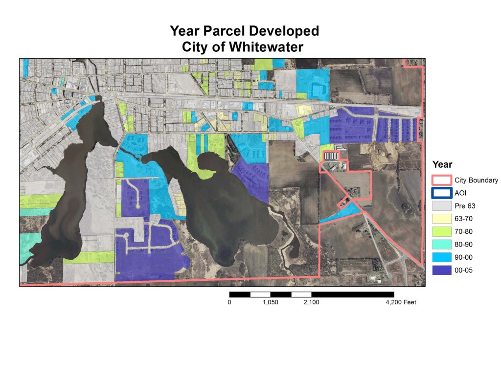

The past century of American history have seen radical changes in the American urban landscape stemming from increased use of and dependency on the automobile. The expansion of the urban footprint in small towns has received much less attention than larger metropolitan areas. My undergraduate research project sought to address that gap in research through a detailed exploration of both changing land use patterns and the expansion of the urban footprint in Whitewater, Wisconsin, through the use of incremental aerial photographs and GIS.
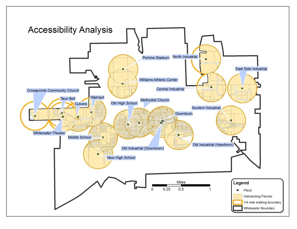
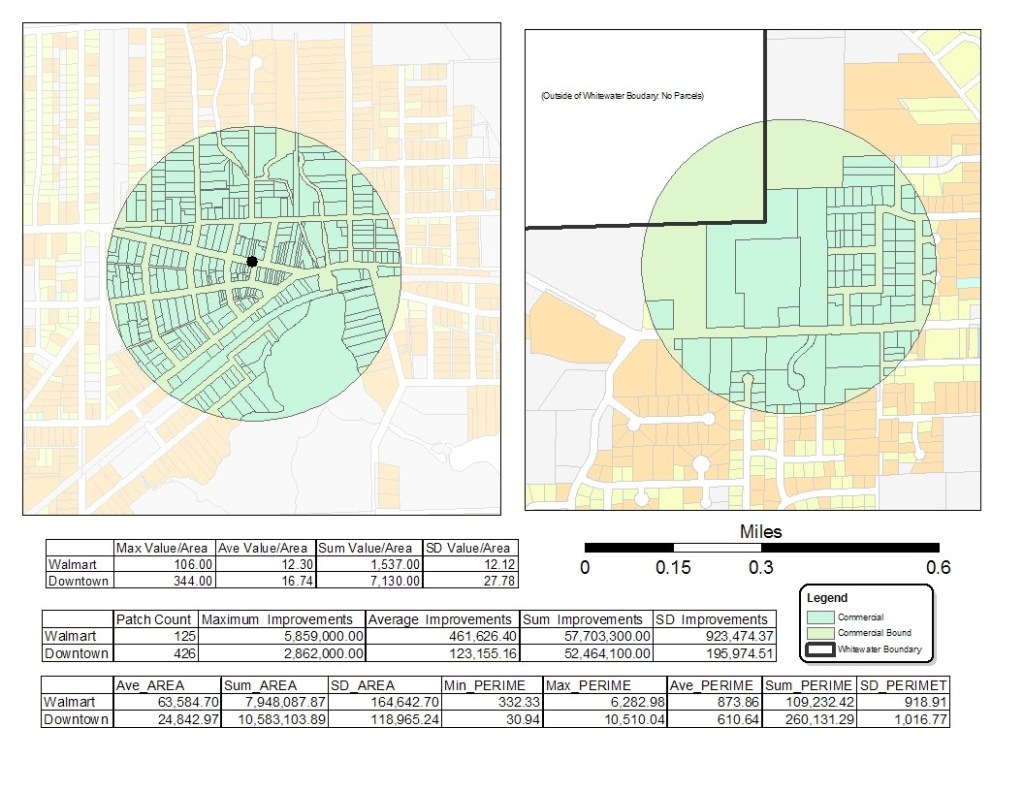
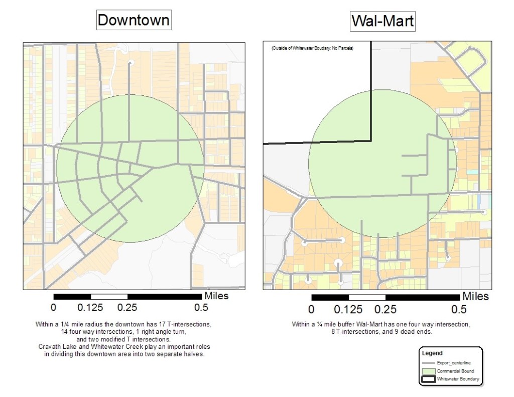
The city exists within a broader regional context characterized by considerable increases in urban land consumption in recent decades and a rising concern over the effects of sprawl. Although there are multiple interpretations of the term “sprawl,” nearly all planners agree that it represents unhealthy growth. This study will document and fully explore the role played by the automobile in reshaping Whitewater’s urban configuration. Therefore, this study focused primarily on how building typologies, street geometries, pedestrian access, and residential density have shaped Whitewater, WI from 1965 to the present.
The following growth patterns were used to define sprawl and demonstrate its hindrance to the pedestrian: leapfrog development, big box and commercial strip development, low density residential areas, large expanses of single-use automobile dependent development, and lack of civic places or public open space (Gillham 4-7).
In recent years, planners have articulated an alternative to automobile dependent development morphologies in “traditional neighborhood development” (TND). This study will conclude with an exploration of the possibilities of importing the TND concept to Whitewater.

Leave a comment