
Author: Joseph Kempf
-
Trace 101 in Utility Network
If you are interested in getting started with the Utility Network, one great place to start is the following blog article: Learning about the ArcGIS Utility Network (esri.com). It will will provide links to digging deeper into each domain (industry). Utility Network Foundation Solutions: Another geat place to learn is through ArcGIS Solutions. Let’s take…
-
Learning ArcGIS Utility Network
If you are interested in hands-on materials to get familiar with ArcGIS Utility Network, here are some excellent resources: Each of these provide industry-specific solutions, tutorials, articles, and resources for further learning in an interactive learning format. Likewise, if you are interested in best practices for implementing and deploying ArcGIS Enterprise, including reference system and…
-
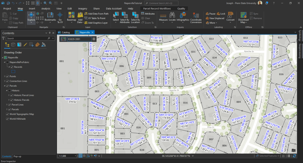
ArcGIS Parcel Fabric
A city’s parcels dataset is used to maintain ownership and tax information, record zoning and other planning designations, track annexations, maintain corporate boundaries, and develop future land-use plans. (Foster and Blanford) ArcGIS Parcel Fabric – Records Feature Class: What is a “Records” feature class? It’s derived from from legal descriptions filed in county recorder offices…
-
Jefferson County Colorado
Hans van der Kwast has an excellent set of tutorials using open-source software at at GISOpenCourseware.org. One of my favorite QGIS tutorials of his utilizes HydroSHEDS data. It felt like there was still something missing after completing the tutorial and it seemed that adding a DEM to the map would provide much more context. Hillshade…
-

Data Validation in ArcGIS Pro
How do you make sure that your data is clean and consistent? One great way is through the use of Attribute Rules. There is a great tutorial in the ArcGIS Pro Documentation. Here is the data: Data Reviewer for ArcGIS Pro Tutorial If you are looking for more, here are some great notes from Penn…
-

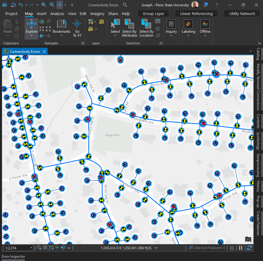
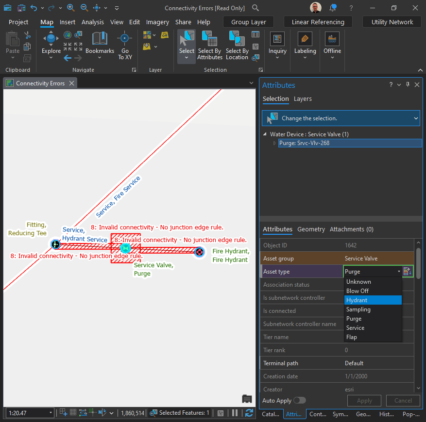
ESRI Utility Network
I spent some time today going through the following ESRI Tutorial: Fix connectivity errors in a utility network (learn.arcgis.com). I think the ESRI tutorials are a fantastic resource. They hit on so many topics that I didn’t have the opportunity to study in my undergrad. Topics pertaining to the Utility Network fall in that category.…
-
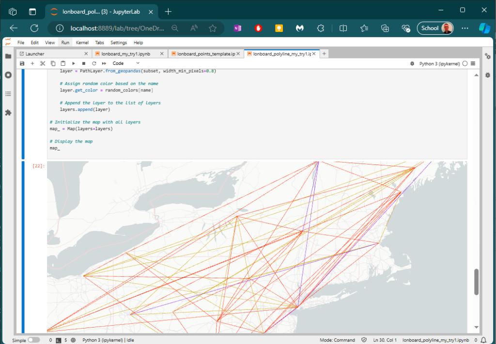
Lonboard
“Lonboard” is a new binding to the deck.gl geospatial data visualization library. A “deck” is the part of a skateboard you ride on. What’s a fast, geospatial skateboard? A lonboard. It’s a play on words with “longboard” – a type of “long” skateboard especially designed for its speed. Here is a short snippet of code that will assign…
-

Transitions
I used to be one of those people that would do anything to avoid sitting in front of a computer and this was the biggest reason why I never pursued a career in GIS upon graduating from university. Life has a funny way of bringing you full circle sometimes. Even before COVID I found myself…
-
Leaflet Web Maps Made Easy
If you had asked me a year ago about the idea of making a web map, I probably would have laughed because that’s just how hopeless I am when it comes to such things. I took a mandatory class in HTML 20 years ago and learned how to draw a box and things had stopped…
-
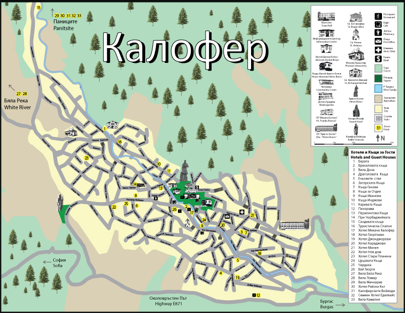
Tourist Map – Peace Corps Bulgaria:
The following map was made during my service in the Peace Corps. The tourist information board was situated in the center of Kalofer displaying hotels, museums, and other important attractions and amenities.
